Description
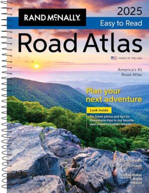
Rand McNally United States Interstate Fold Map
Product Description
Discover the open road with Rand McNally’s United States folded map, your essential companion for every journey. This meticulously crafted map features clear and easy-to-read cartography, showcasing all Interstate and U.S. highways. It also highlights cities, points of interest, airports, boundaries, and much more. For years, Rand McNally folded maps have been the trusted standard, delivering unbeatable accuracy and reliability at an exceptional price.
Key Features:
- Comprehensive coverage of Interstate and U.S. highways
- Clearly indicated cities, points of interest, airports, and boundaries
- Mileage chart and driving times map for efficient planning
- National facts and symbols for a deeper understanding of the landscape
- Toll roads chart for navigating expenses
- United States physical map for geographic context
- Visitor information for travelers
Product Details:
- Measures: 4.125″ x 9″ (folded), 25.5″ x 36.75″ (unfolded)
Read More
User Feedback
Rand McNally’s map has garnered a variety of reviews from users who appreciate its practical benefits and nostalgic charm:
-
Planning & Navigation:
“Great map. Good to have for planning and in the car.” -
Backup to Electronics:
“With all the navigation apps these days, people seem to have lost the ability to find their way without a synthesized voice… All technology fails at some point, but paper maps are there when you need them.” -
Cross-Country Travels:
“Used it to move cross country from the Oregon Coast to Florida. It was fun marking our journey.” -
Road Trip Planning:
“Used it to plan our road trip. Easy to read.” -
Detailed Information:
“Very detailed and essential to have a paper map just in case GPS or satellite is not working!”
What Makes It Stand Out
Rand McNally’s United States Interstate Fold Map stands out for its rich detail and practicality. Unlike digital maps, this paper map offers a comprehensive view of the country’s layout, allowing users to understand distances and routes without the limitations of a screen.
Unique Elements:
- Offers a tangible perspective of geography, enhancing the travel experience.
- Includes features like a mileage chart and toll roads chart that are often overlooked in digital formats.
The Takeaway
Travelers can expect to gain a wealth of knowledge from Rand McNally’s map. It enriches the travel experience by providing a holistic view of the roadways, fostering a sense of adventure as you plan your next journey. This map serves not just as a navigation tool, but as a reminder of the beauty of exploration.
Who Should Consider This
This map is perfect for:
- Road trip enthusiasts looking to plan their adventures.
- Families and travelers who want a reliable backup to their GPS.
- Students and geography buffs interested in learning about U.S. geography in a hands-on way.
In-Depth Review
The Rand McNally United States Interstate Fold Map is a reliable and detailed resource, perfect for both seasoned travelers and those embarking on their first road trip. Users praise its clarity and accuracy, with many highlighting its usefulness alongside modern navigation tools.
Standout Features:
- Easy-to-read cartography enables quick navigation.
- The foldable design makes it portable and convenient for travel.
- User feedback emphasizes its detailed nature, making it more than just a map—it’s an experience.
Pros and Cons
Pros:
- Comprehensive and accurate representation of U.S. highways
- Durable and easy to handle
- Great for planning and spontaneous adventures
Cons:
- Some users find it a bit expensive compared to previous prices.
Discover More
Explore the open roads of America with Rand McNally’s United States Interstate Fold Map, a timeless tool that enhances your travel experience and provides the assurance that you’re always on the right path. Whether navigating the interstate or exploring hidden gems, this map is your ultimate companion!


Reviews
There are no reviews yet.